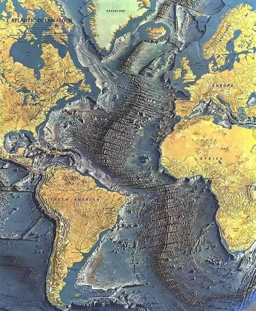
It's a map of the Atlantic Ocean floor published in 1968 based on a large number of deep ocean soundings compiled by Bruce Heezen and Marie Tharp, painted by Heinrich Berann. Marie Tharp (1920–2006) was an American Geologist and oceanographic cartographer who, in partnership with Bruce Heezen, created the first scientific map of the Atlantic Ocean floor. Tharp's work revealed the presence of the mid-Atlantic Ridge, causing a paradigm shift in Earth science that led to acceptance of the theories of plate tectonics and continental drift.
The Mid-Atlantic Ridge is a mid-ocean ridge, a divergent tectonic plate or 'constructive plate boundary' located along the floor of the Atlantic Ocean, and part of the longest mountain range in the world. In the North Atlantic it separates the Eurasian and North American Plates, and in the South Atlantic it separates the African and South American Plates. Although the Mid Atlantic Ridge is mostly an underwater feature, portions of it have enough elevation to extend above sea level. The section of the ridge that includes the island of Iceland is also known as the Reykjanes Ridge. The ridge has an average spreading rate of about 2.5 centimetres (0.98 in) per year.